The University of Vermont’s Spatial Analysis Laboratory team researches the use of drones for emergency response and disaster preparedness. (Photo: UVM Spatial Analysis Lab)
The Federal Aviation Administration’s ASSURE Center of Excellence recently awarded $2.7 million in grants to support research on the use of drones in emergency response situations. This amount included nearly $1.2M that was awarded to the University of Vermont as well as grants to four additional universities. The research targets use of unmanned aircraft systems (UAS) to address both natural and human-made disasters.
The University of Vermont’s Spatial Analysis Laboratory team joined in the efforts of ASSURE, or the Alliance for System Safety of UAS (unmanned aircraft systems) through Research Excellence, at the end of last year. UVM’s Spatial Analysis Laboratory received $1,195,000 in funding in August, according to the FAA.
Jarlath O’Neil-Dunne, Director of the Spatial Analysis Laboratory, spoke about their ongoing research in an interview with Avionics International. “The first phase of the project was much more academic—doing a lot of research on how drones have been used in disaster response,” he explained. “We’re fortunate as part of the research team with ASSURE to actually get out and work with drones.”
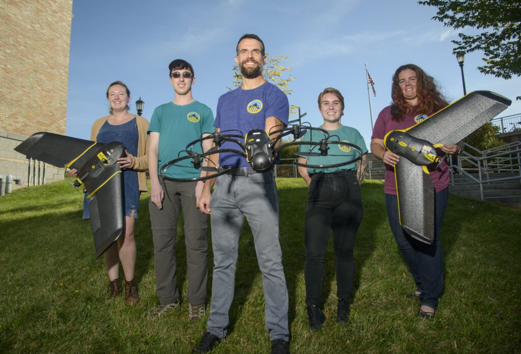

Members of the Spatial Analysis Laboratory at the University of Vermont (Photo: UVM SAL)
The research phase of the project included speaking with people across the U.S. that are involved in responding to natural disasters and managing emergencies. The Spatial Analysis Laboratory (SAL) team talked to sheriffs that are deployed during fires in California, O’Neil-Dunne said, as well as members of the U.S. Forest Service who deal with natural fires and other emergencies on a regular basis.
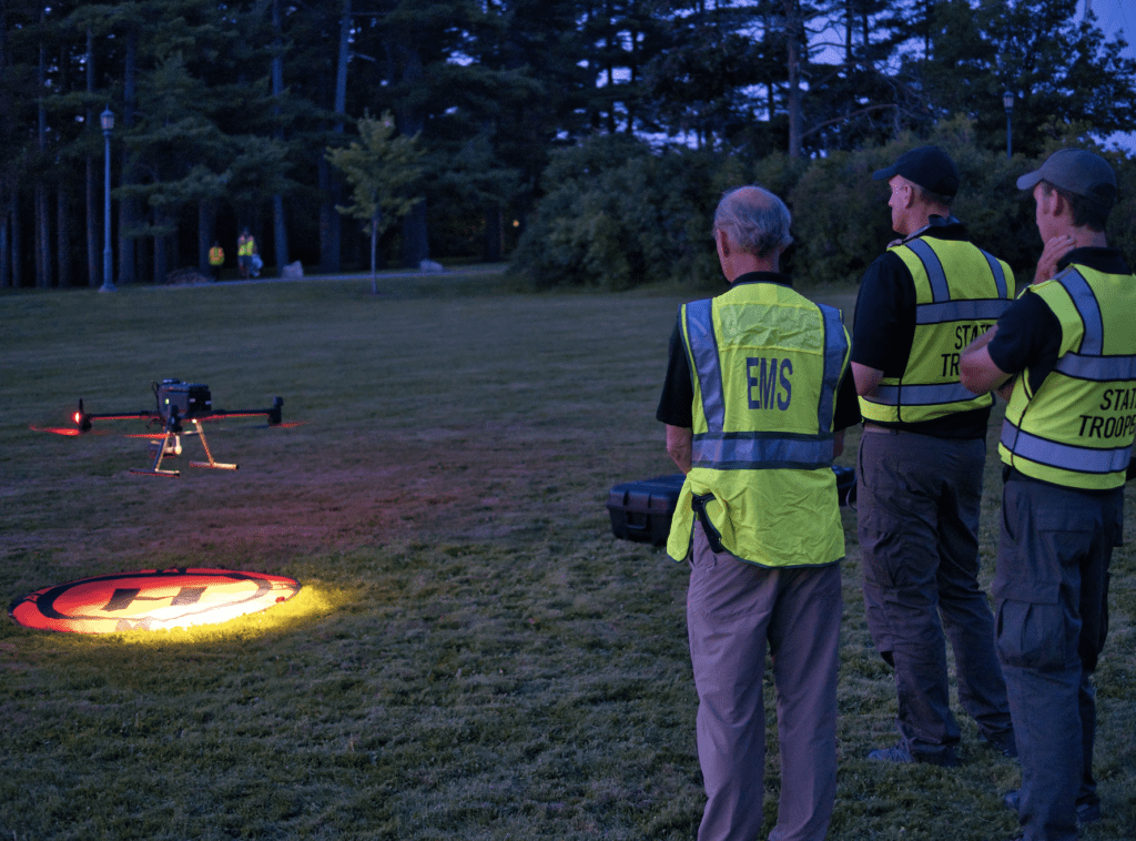
The researchers at the SAL are now progressing through the second phase of this project. “We’re actually going out and doing exercises with first responders and emergency managers to implement the procedures that we’ve developed for this project,” shared O’Neil-Dunne.
One of their objectives is to have so-called “playbooks” for organizations that want to use drone technology. These playbooks would serve as guides for deploying drones in various types of disasters.
“On one hand, drones can be really simple, but on the other hand, there’s a lot of really advanced technology out there,” he noted. “You can easily spend $1,000 on a drone platform or $200,000. What you need to do to operate safely and effectively can change quite rapidly.”
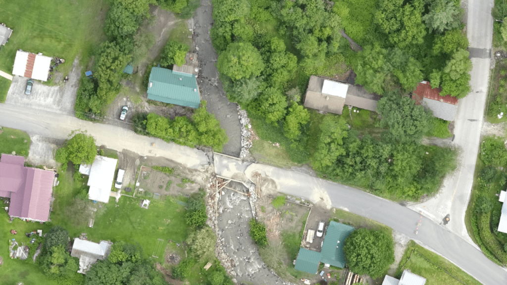

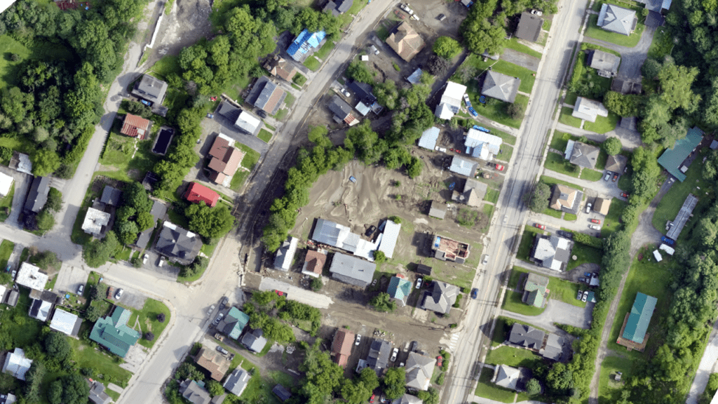
Images taken by drones depict the damage resulting from a disaster and aid in emergency response. (Photos: UVM SAL)
Safety is of utmost importance in operating drones. To ensure that individuals are using the technology in a safe manner, it’s necessary to develop the proper policies, procedures, and checklists for operating UAS.
In the early stages of UVM’s SAL, the researchers became involved in helping communities deal with small-scale flooding events using drones. This demonstrated to the team that UAS technology could offer incredibly helpful tools to first responders and those in emergency management that would enable new levels of situational awareness.
“What we’re seeing now with the FAA and this funding,” O’Neil-Dunne said, “is figuring out how to get this technology into the hands of more people, because it can potentially save lives and speed up recovery.”
He added that part of speeding the recovery process is being able to access verifiable information in order for FEMA to direct the funds to those who need the most help.
One of the main challenges that comes with the increased use of drones is managing the airspace to account for manned and unmanned aircraft. Integrating drones into the same airspace that is already occupied with conventional passenger aircraft—such as helicopters used for medical evacuation, or civil air patrol reconnaissance—is extraordinarily challenging, remarked O’Neil-Dunne.
“We don’t have the centralized control that you do in, for example, a conflict area like Iraq where the airspace is heavily controlled by the military and there’s structure in place,” he explained. “Our emergency services may not be structured like that for these domestic responses.”
In talking to first responders, the Spatial Analysis Laboratory team found that a major impediment to disaster response is a lack of good policies or technology that allows multiple organizations to quickly launch drones in the airspace.
“We’ve seen situations in the past where some of the drones had to be grounded in a disaster until that coordination could be worked out,” O’Neil-Dunne commented.
“The more this technology gets used, the more opportunities it creates for better decisions, and the more challenges we have with respect to the airspace, safe operation, and coordination,” he added. “Our ability to put things up in the air has far surpassed, at least for right now, our ability to coordinate these things flying in the air.”
 :
: