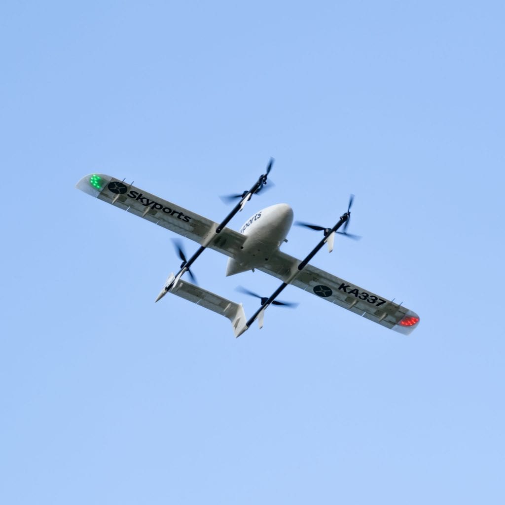
During the project, Skyports worked with Kongsberg Geospatial to enable beyond visual line of sight (BVLOS) flights. (Skyports)
Skyports, the drone delivery company, recently completed a medical drone delivery project in Scotland demonstrating an overall 90 percent reduction in average transportation time. During a June 2 webinar, Jef Geudens, head of technology at Skyports, explained how they were able to conduct 14,000 km of beyond visual line of sight drone flights and what made the project successful.
“We’re a drone delivery service provider so what sets us apart is that we’re not a manufacturer,” Geudens said. “What we bring is we bring best in class drones. We work very closely with those manufacturers, and what we provide is an operational safety case. We engage closely with the regulator, we get all the regulatory approvals, we provide the pilots, and we provide the end service to the customer.”
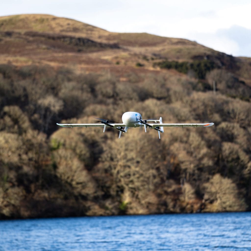
Skyports project in Scotland was funded by a joint initiative of European and UK Space Agencies to support COVID-19 healthcare applications, Geudens said. It lasted three months, from February to May 2021, and was able to complete 14,000 km of beyond visual line of sight (BVLOS) flight. The drones carried COVID-19 test samples and kits, medicine, and essential personal protective equipment.
“Overall, we did three months of operations, and the goal was to reach five to nine return flights a day,” Geudens said. “In the end, we ended up flying between four medical centers. So, we were operating on the three routes, the three outposts, and the one central lab in Obon. Overall, during these three months only we managed to save 11,640 hours in transport time.”

Skyports project in Scotland was funded by a joint initiative of European and UK Space Agencies to support COVID-19 healthcare applications. (Skyports).
During the project, Skyports worked with Kongsberg Geospatial to enable beyond visual line of sight (BVLOS) flights.
“We’re working with Kongsberg to demonstrate the capabilities of the system to the to the regulator here in the UK so that we can work with them on the integration of these drones into, into the airspace of manned aircraft, if we can show that we are able to detect them, we’re able to see all the other aircraft operating in the area, and that we can avoid them accordingly,” Geudens said.
Skyports uses Kongsberg’s Iris system which provides operators visualizations in 2D and 3D, Paige Cutland, Iris program director at Kongsberg Geospatial, said.
“Iris is a display application that we brought to the market about five or six years ago, and it was derived from the operator visualization the user interface, if you will, or a military surface to air missile system,” Cutland said. “So this provided very precise visualization for an operator just to see the surrounding airspace in 2D and 3D, and what we did was repurpose or reuse that user interface for commercial UAS applications.”
Iris uses sensor and feed services like ANSP, ADS-B, and radar to provide detect and avoid, terrain avoidance, airspace alerts, and vehicle alerts, Cutland said.
“So, the goal of Iris and our path with it, if you will, is to reduce the cognitive load of the operator by providing increasing levels of decision support,” Cutland said. “We can manage multiple domains, error surface and subsurface, multiple vehicles simultaneously, talking to more than one autopilot at a time, and trying to make the operator more of an airspace manager than a pilot. And that allows them to be able to do more things and manage more vehicles simultaneously.”
Geudens said they had successful airspace management deconfliction during the project and were able to complete the three-month duration without a single incident.
“We managed to facilitate dual aircraft operations as well,” Geudens said. “Basically, operate like how big airports are operating. So, send out a wave of drones, pick up samples and then have a wave of arriving drones at the same time. We managed to integrate the Iris software from Kongsberg, which was a really big help because it gave us that beyond horizon visibility of where potential airspace users are.”
Geudens said in the coming months they will begin projects in the U.S. as well.
“We are working with partners there [the U.S.] as well,” Geudens said. “I’m not too sure if I can say too much about that, but we’re working with local partners there and we will be doing our first demos there over the next couple of months.”
 :
: