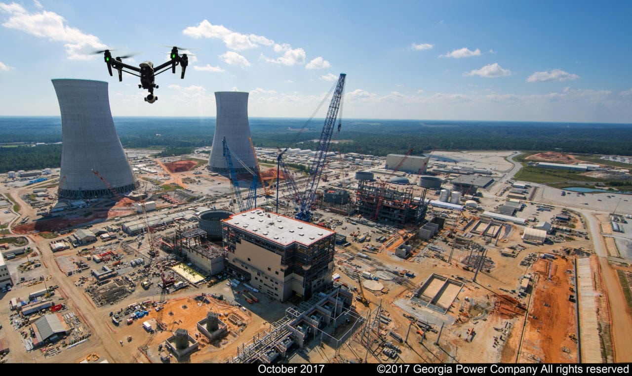
Drone (Georgia Power)
Unmanned traffic management (UTM) platform provider AirMap has been busy this week. It’s developing a drone tracking device with Honeywell, collaborating with Fortem on a geofencing UTM service and just announced plans to begin work with air navigation service providers (ANSPs) in Switzerland and the Czech Republic.
Hardware with Honeywell
AirMap and Honeywell’s solution will broadcast real-time telemetry information of drones and other low-altitude aircraft to UTM systems for visualization and monitoring by ANSPs and other authorities. The device will support multiple communication options, including 4G and satellite for areas without 4G coverage, according to AirMap.
“The AirMap UTM Platform is designed to provide a real-time operating picture of the airspace for both manned and unmanned aircraft,” said AirMap Chairman Ben Marcus. “We’ve partnered with Honeywell to deliver an easy-to-use, cost-effective, and drone-agnostic device as a practical way to start managing drone traffic in any environment, today.”
The tracker device is currently available for testing.
Finding Rogues with Fortem
What AirMap is doing with Fortem bridges the two companies’ products to provide a more robust solution. It relies on Fortem’s TrueView radar to collect information, SkyDome to aggregate and distribute that data, and AirMap’s platform acts as the UAS service supplier (USS), providing an interface for users to see airspace rules so they can stay within corridors and geofences constructed by SkyDome.
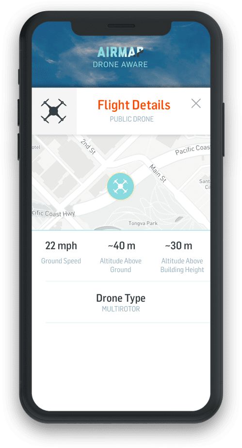

AirMap’s InterUSS app tracking a drone. (AirMap)
SkyDome will identify all known and unknown detected airborne objects, matched against flight plans. Deviation from guidelines gets an aircraft marked as rogue for authorities to handle.
“Fortem digitizes the airspace above and around infrastructures, campuses, venues and cities to enable safe and reliable drone services,” said Fortem CEO Timothy Bean in a statement. “Our low-cost, networkable system supports USSs like AirMap to pave the way for drone package delivery, autonomous people transportation, and general urban air mobility.”
Bringing LAANC to Switzerland
In Switzerland, ANSP Skyguide has entreated the company to help it deploy low-altitude authorization and notification capabilities (LAANC) in major Swiss cities Geneva and Lugano.
LAANC is important for the growth of the drone industry because it allows for the automated, near-real-time approval of flight plans in controlled airspace, which accounts for most operations.
Skyguide is launching a trial phase of LAANC in Geneva and Lugano, allowing select drone operators to apply for automated and manual flight authorization through either the Skyguide app that AirMap provides or third-party apps built using AirMap APIs.
“Digital and automated airspace authorization is a critical enabler for scaling high-value drone operations,” said Marus said. “We’ve experienced this first-hand through our work with the FAA in the United States.”
The trial marks the first time fully automated drone flight approval will be possible outside of the U.S. The FAA’s LAANC is a jumping off point for what AirMap is doing in Switzerland, the company said.
“The trial phase enables us to gain vital information and experience with selected users live in the field and therefore to make sure that this pioneering system is running smoothly and reliably when launched in June,” said Skyguide’s Robert Fraefel.
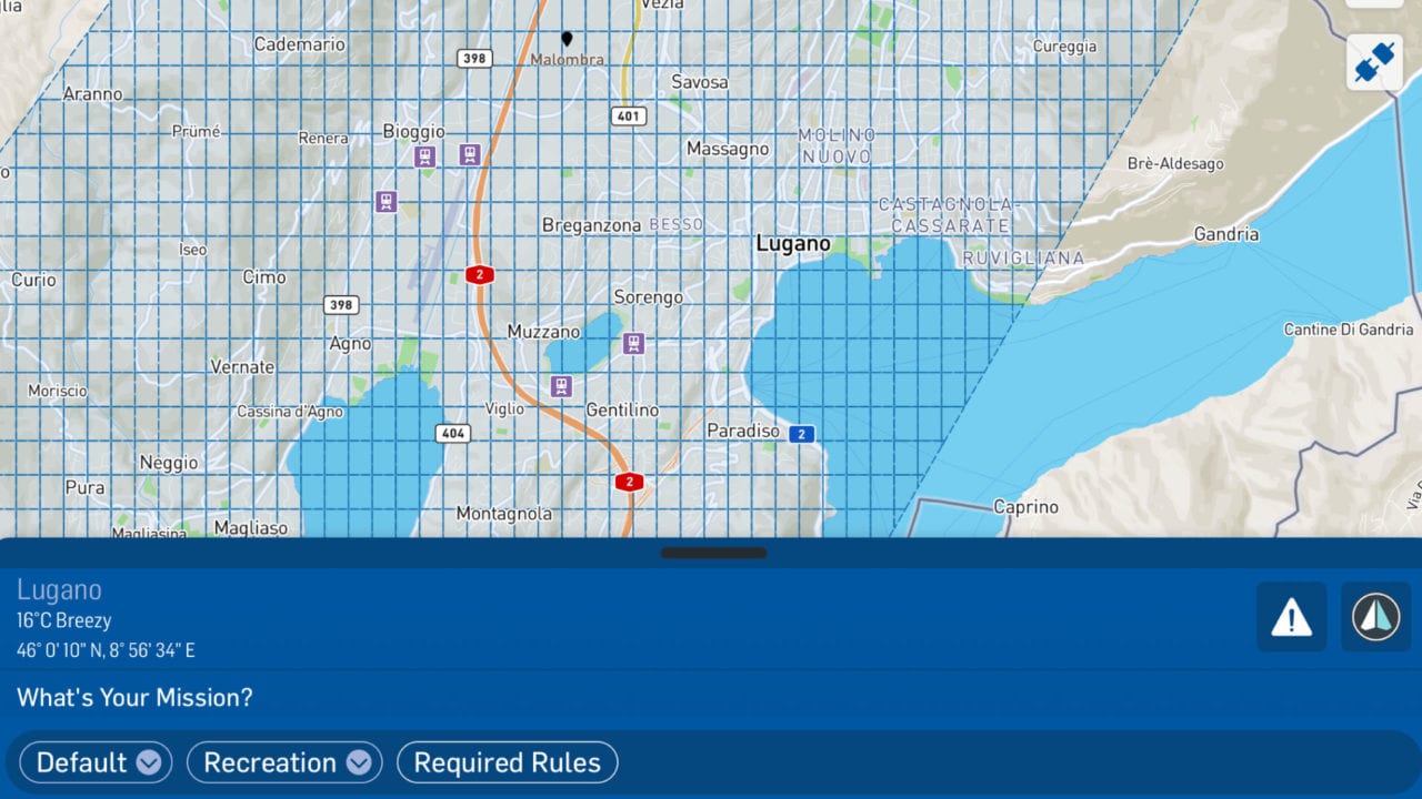

AirMap’s App for Skyguide to enable LAANC in Switzerland. (AirMap)
Smarter Czech Skies
Switzerland isn’t the only place AirMap is working with an ANSP. The Czech Republic last year launched an initiative, Smart Sky, aimed at digitizing low-altitude airspace to create an ecosystem that facilitates drone use.
In August, Czech ANSP ANS CR deployed Air Map’s platform in the country with localization and technical support from Prague-based UpVision.
The three entities are now working to develop a roadmap that furthers the Czech Republic’s integration of drones into its airspace, aiming for a fully operational UTM by 2020, enabling all of the following:
- E-registration and e-identification for users and drones
- Pre-tactical geofencing and flight planning
- Automated and manual digital airspace authorization
- Real-time traffic alerts for drone pilots and live drone telemetry for airspace managers
- Connectivity and communication between drone pilots and airspace administrators
 :
: