  |
| Bahrain International Airport. Photo: Bahrain International Airport |
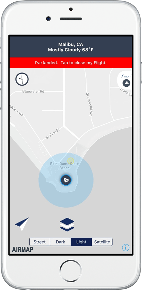
[Avionics Today 08-04-2016] The Weather Company has partnered with AirMap, a provider of low-altitude airspace management services for Unmanned Aircraft Systems (UAS), to deliver real-time hyperlocal weather data directly to drone operators. Drone operators will be able to access the data via AirMap’s app for iOS, as well as the company’s Application Program Interfaces (APIs) for developers.
Additionally, under the FAA’s new Part 107 regulations, clearing UAS for departure on Aug. 29, remote pilots of unmanned aircrafts are required to be familiar with available weather information prior to flight departure.
“Part 107 is a major milestone in drone regulation for visual line-of-sight operations,” said Ben Marcus, CEO of AirMap and an airline transport rated pilot and flight instructor. “The availability of real-time hyperlocal weather data from The Weather Company will help today’s drone pilots avoid hazardous and severe weather, and will be absolutely critical for safe, efficient flight planning and operations of more autonomous, beyond visual-line-of-sight drones.”
 :
: