 |
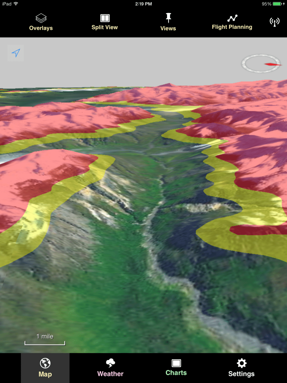
| NASA’s TAIGA technology system is capable of showing pilots the altitude of nearby terrain via color. Photo: ARC/Joseph Rios via NASA |
[Avionics Today 10-07-2014] NASA has formally delivered to Alaskan officials a new technology that could help pilots flying over the vast wilderness expanses of the northern-most state. The Traffic and Atmospheric Information for General Aviation (TAIGA) software, is designed in accordance with NextGen initiatives to help pilots make better flight decisions, especially when disconnected from the Internet, flight services and other data sources.
According to NASA, pilots are often disconnected from vital navigation aids and communication while flying through Alaska, due to the mountainous terrain and extreme weather events. Taking on these factors, NASA developed a satellite-based communication method through which regional data is sent only to that specific region. The customized data sets can be downloaded quickly and plugged into a mobile application.
NASA has developed only a conceptual version of the mobile software application, which includes full 3-D terrain visualization. The algorithms, concepts and data are available as an open-source project for further development by industry and the aviation community into an end-user system. The 3-D terrain visualization software will be made available separately.
 :
: