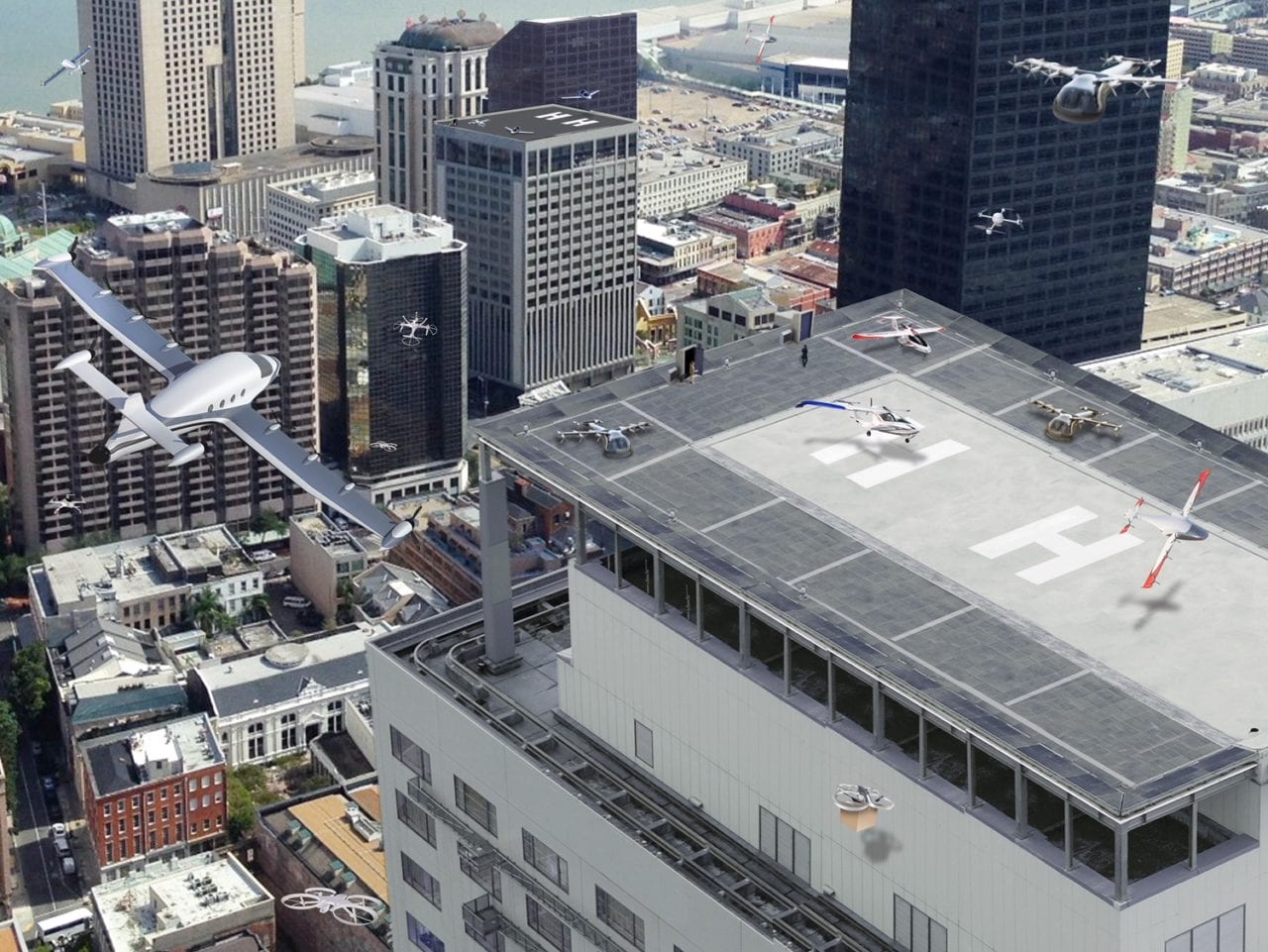
A NASA rendering of a city whose airspace is filled with drones and passenger aircraft. (NASA)
NASA has selected a new third-party service to aid it in tracking everything from air taxis to package-delivery drones in urban areas. The government organization will integrate NextNav’s 3D geolocation services into its City Environment for Range Testing of Autonomous Integrated Navigation (CERTAIN) efforts at the Virginia Langley Research Center.
NextNav uses a metropolitan beacon system (MBS) that uses a network of terrestrial satellites to provide precise locations without potential interference from localized weather or GPS outages. As the FAA, NASA and other organizations responsible for the national airspace system grapple with the coming expansion of low-flying unmanned vehicles and the efforts of companies such as Uber to implement urban mobility projects (to which NASA is no stranger), one of the major obstacles to overcome is the tracking of that increased traffic. That is an especially difficult task in cities and at low altitudes where traditional solutions like radar, GPS and ADS-B are unreliable or insufficient.
The FAA estimates there will be over 700,000 drones delivering packages and performing other tasks by 2022. Because Uber and Bell plan to scale their on-demand mobility venture from a soft opening to nationwide operations by the following year, the need to precisely track vehicles moving throughout city airspace is imminent. At Langley, NASA has a test facility, test flight range and “autonomy incubator” where it experiments with tracking technologies.
“NextNav’s MBS system provides us with new tools for the development of navigation systems in environments where GPS has traditionally been challenged,” Evan Dill, of NASA’s safety-critical avionics systems branch, said in a statement. “We’re looking forward to working with MBS as we develop new approaches to the operation of unmanned systems in urban environments.”
NextNav’s system is designed to work alongside GPS, according to a company representative, helping to fill in the gaps in location data GPS provides. That strategy of adding layers of additional sensors to bridge altitudes and provide redundancies is a common one being pursued in the expansion of the NAS to include these new entrants. The MBS uses the same ecosystem as GPS, relying on the same chipset and software to relay information.
“We are proud to work with NASA and integrate MBS into its urban drone operations,” said Ganesh Pattabiraman, co-founder and CEO of NextNav. “The MBS system is designed for secure, reliable and consistent 3D Geolocation capabilities which are important for autonomous systems such as drones. NASA’s acquisition of the MBS system is an exciting milestone for MBS technology and a great partnership with NASA to address the key challenges in urban drone navigation and make it possible to explore new opportunities in unmanned operations.”