 |
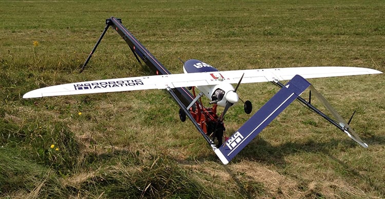
| ING Robotics’ Serenity UAV. Photo: ING Robotics |
[Avionics Today 10-28-2014] Canada-based company ING Robotic Aviation has launched the next version of its Serenity fixed-wing Unmanned Aircraft System (UAS), equipped with a wide area rapid mapping capability.
The Serenity 1.1 UAS, an extended range and long endurance platform, has a customized commercial mapping payload and can perform 2-D and 3-D aerial mapping using a 36 Megapixel aerial imager. The system has the capability to map vast amounts of land in a single eight-hour flight.
Airbus and Provincial Aerospace Reach Teaming Agreement for Canada’s Fixed-Wing Search and Rescue Aircraft Program
[Avionics Today 10-28-2014] At the Maritime and Arctic Security and Safety (MASS) conference, in St. John’s, NL, Airbus Defense and Space and Provincial Aerospace (PAL) reached a 20-year teaming agreement to pursue Canada’s Fixed-Wing Search and Rescue (FWSAR) aircraft program with Airbus Defense and Space’s C295 aircraft. This agreement follows from a memorandum of understanding signed earlier this year by the two companies.
Through this agreement, Provincial Aerospace will be the main Canadian In-Service Support (ISS) partner for the C295 team seeking to replace Canada’s aging CC-115 Buffalo and CC-130 Hercules aircraft currently being used for search and rescue duties.